We at Preferred Survey, Inc. endeavor to provide our customers with surveys of the highest quality and accuracy.

We at Preferred Survey, Inc. endeavor to provide our customers with surveys of the highest quality and accuracy.

We at Preferred Survey, Inc. endeavor to provide our customers with surveys of the highest quality and accuracy.

We at Preferred Survey, Inc. endeavor to provide our customers with surveys of the highest quality and accuracy.

scroll icon
PSI Process

Our Process

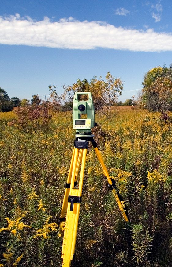
Our team is focused on end-to-end automation of your survey order. Our field crews are fully trained the proper use of E.D.M. Total Stations using infrared laser technology to provide the most accurate measurements of your property and any improvements to the land. Our Professional Land Surveyors apply over a century of combined experience to distilling measurements taken in the field into exact renderings of your property. Our CAD techs use state-of-the-art software to create your final survey which is seamlessly delivered to you electronically upon completion.

Surveying in 6 Counties

We are able to provide an extensive coverage of the northern portion of the state covering 6 counties.

Our goal is to provide these services in a timely fashion and at a fair market price.

Top of the line Survey Equipment

Our technicians are highly trained on today’s most innovative survey equipment.

Our drafting department is fully automated, guaranteeing accuracy.

Our Products

Boundary Survey / Plat of Survey

A Boundary Survey is recommended before buying, subdividing, improving or building on land. The purpose of a Boundary Survey is to map and identify the location of property lines. The surveyor looks for any easements, encroachments, surrounding property [...] and past documented records. Easements can include utilities such as water, sewer and power lines on the property. Encroachments refer to any person, other than the owner, utilizing the land that isn’t authorized to do so. Examples of an encroachment include: neighboring driveways, fences, structures, etc. that go past the property line. Once the Boundary Survey is completed the surveyor then creates a “Plat of Survey” that documents all pertinent information to that property. A Boundary Survey is commonly completed prior to buying property because it legally protects against future disputes and rebuilding.

ALTA/NSPS Survey

An ALTA Survey conforms to the standards set by the American Land Title Association (ALTA) and the National Society of Professional Surveyors (NSPS) Land Title Survey Specifications. It is a detailed map of the land that shows [...] all existing improvements, utilities, major observations, and any possible areas indicating potential future use within the land. An ALTA Survey is the most extensive survey because it combines information from the Boundary, Title, and Location Surveys. An ALTA Survey’s precise detail makes it beneficial to lenders, corporations, title companies, general public, architects, engineers and contractors. A current title commitment is required prior to conducting an ALTA Survey.

Subdivision/Tax Division Survey

A Subdivision Survey takes a large parcel of land and divides it into smaller parcels. This survey must meet the guidelines and jurisdictions of a local agency (village, town etc. within the boundaries that the parcel is located).

Chicago Condominium Survey

A Condominium Survey is a survey of new construction or conversion of an existing building that delineates the limits of ownership, both horizontal and vertical, for [...] each unit, and those common ownership areas within the condominium association. This type of survey must meet a specialized standard set by the “Condominium Property Act.” In addition to exterior boundaries, the survey identifies individual condominium units, and parking spaces.

Topographic Survey

A Topographic Survey focuses on the configuration (relief) of the surface of the land and the location of naturally occurring objects and artificial improvements. The purpose [...] of this survey is to identify the terrain and existing features that are below or above the land surface (trees, buildings, utility poles, retaining walls etc.). Topographic Surveys are essential for architects, land owners and developers because they are accurate 3D depictions of the land.

Construction Surveying

This process lays out calculated survey points for a property in which improvements are to be constructed which serve as a guide in the construction of those improvements [...] as set forth from plans prepared by a design professional, such as an architect. Aspects of this process include surveying the existing land and improvements, setting stakes to represent the lot corners, limits of work areas, construction trailer location, and other markers to guide in the construction of the new structures. A foundation survey is completed to confirm the location of the foundation is correct. Later, an As-Built Survey verifies the work has been completed in accordance with the set of plans.

Contact Us

  • This field is for validation purposes and should be left unchanged.